Ah, the marvels of modern technology never cease to amaze me, especially regarding the incredible capabilities of thermal imaging drones. As someone deeply entrenched in aerial surveillance and cutting-edge gadgetry, I’ve witnessed firsthand the transformative power of these flying marvels. Picture this: a sleek drone with a specialized thermal camera takes flight, effortlessly scanning its surroundings with infrared precision. From detecting hidden heat signatures to unraveling mysteries in the dead of night, the applications are as diverse as they are awe-inspiring. Join me as we explore the myriad ways these high-tech wonders are reshaping industries and revolutionizing our understanding of the world around us. Strap in, dear readers, because the view from here is extraordinary.
Understanding Thermal Imaging Technology
Welcome back, curious minds! Today, let’s explore the fascinating world of thermal imaging technology.
Principles of Thermal Imaging
- Explanation of Infrared Radiation: Imagine a world beyond what the eye can see, where objects emit heat in infrared radiation. Thermal imaging captures this radiation, converting it into visible images that reveal temperature variations. It’s like peering into a secret realm, where every object tells its own thermal story.
- Heat Detection Mechanisms: How does our trusty thermal camera discern between hot and cold? It’s all about those nifty heat detection mechanisms. These cameras contain sensors that measure the intensity of infrared radiation emitted by objects. The warmer an object, the more intense the radiation, allowing the camera to paint a vivid picture of the thermal landscape.
Advantages of Thermal Imaging in Drones
- Enhanced Visibility in Low-Light Conditions: Picture this scenario: the sun bids farewell, and darkness descends. Traditional cameras struggle to capture clear images in low-light conditions. But fear not, for our thermal imaging drones come to the rescue! Equipped with infrared sensors, they pierce through the darkness, providing crystal-clear visuals even when the world seems shrouded in shadow.
- Detection of Heat Anomalies: Have you ever wondered what lies beneath the surface? Thermal imaging drones hold the key to unraveling this mystery. By detecting heat anomalies invisible to the naked eye, these high-flying marvels unearth hidden treasures and potential dangers alike. From spotting elusive wildlife to uncovering underground pipelines, the possibilities are endless when you have thermal imaging technology at your fingertips.
Components of a Thermal Imaging Drone
Hey there, budding drone enthusiasts! Today, let’s look at what makes up the powerhouse: a thermal imaging drone.
Drone Hardware
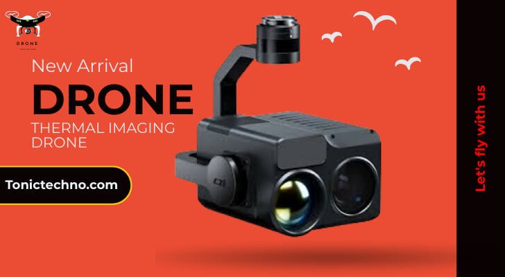
- Specialized Thermal Camera: Picture your trusty camera but with a thermal twist! These specialized cameras are the heart and soul of thermal imaging drones. They’re equipped with infrared sensors that detect and translate heat signatures into vivid thermal images. It’s like having superhero vision but in the palm of your hand!
- Integration with Drone Systems: Let’s talk about teamwork. Thermal cameras don’t fly solo; they’re seamlessly integrated into drone systems. These drones are designed to carry and operate thermal cameras, ensuring smooth aerial reconnaissance missions. With a flick of a switch, these drones transform into thermal imaging powerhouses, ready to soar into the skies.
Software Capabilities
1. Image Processing Algorithms: Have you ever heard of digital magic? That’s precisely what happens behind the scenes with image processing algorithms. Once the thermal camera captures images, these algorithms work their magic, enhancing clarity and highlighting crucial details. It’s like having a digital artist on board, ensuring every thermal image tells a captivating story.
2. Data Analysis Tools: Now that we have images, it’s time to dive into the data. Data analysis tools sift through the thermal pictures, identifying patterns, anomalies, and trends. From pinpointing hotspots to tracking temperature changes over time, these tools unlock valuable insights that drive informed decision-making. It’s data analysis at its finest, guiding us through the thermal wilderness with precision and clarity.
Surveillance and Security Applications
Greetings, vigilant readers! Today, we’re delving into the surveillance and security applications of thermal imaging drones—strap in as we explore how these high-flying gadgets are transforming the landscape of security operations.
Monitoring Perimeter Security
- Identifying Intruders or Trespassers: Imagine a scenario where a trespasser lurks in the shadows, unseen by traditional security measures. Here’s where thermal imaging drones swoop in to save the day! These drones can detect heat signatures with infrared sensors, easily spotting intruders even under darkness. It’s like having a silent sentinel patrolling the perimeter, keeping watch when humans can’t.
- Protecting Sensitive Sites: Some places are so sensitive that even the slightest breach can spell disaster. Enter thermal imaging drones, the guardians of sensitive sites! By continuously monitoring thermal signatures, these drones provide real-time alerts to any potential threats. Whether a covert entry or an unexpected hotspot, these aerial sentinels ensure that sensitive sites remain safeguarded.
Law Enforcement Operations
- Search and Rescue Missions: Every second counts when lives hang in the balance. Thermal imaging drones are pivotal in search and rescue operations, especially in challenging terrain or adverse conditions. Their ability to detect body heat signatures aids rescuers in swiftly locating lost or injured individuals. It’s like having a guardian angel in the sky, guiding rescuers to those in need with unwavering precision.
- Tracking Suspects in Pursuits: Criminals on the run may think they can evade capture, but they’ve met their match with thermal imaging drones. These aerial detectives track suspects from above, providing law enforcement with crucial visual data during pursuits. Whether a foot chase through urban alleys or a vehicular escape across rugged landscapes, thermal imaging drones keep a watchful eye, ensuring that justice prevails.
Environmental and Wildlife Conservation
Hey there, nature lovers! Today, we’re embarking on a journey into environmental and wildlife conservation with the help of thermal imaging drones. Let’s discover how these high-tech marvels safeguard our precious ecosystems and the creatures that call them home.
Wildlife Monitoring
- Tracking Endangered Species: In the vast wilderness, endangered species often elude human eyes, challenging conservation efforts. However, with thermal imaging drones, conservationists gain a powerful ally. These drones soar above the treetops, scanning the landscape for elusive creatures. Detecting their heat signatures, they help researchers track and protect endangered species, ensuring their survival for future generations.
- Preventing Poaching Activities: Poaching remains a significant threat to wildlife worldwide, pushing many species to extinction. Thermal imaging drones act as silent guardians, patrolling vulnerable habitats and watching for signs of illegal activity. With their ability to detect human and animal heat signatures, these drones help authorities intercept poachers before they can inflict harm, safeguarding wildlife from harm’s way.
Environmental Surveys
- Detecting Forest Fires: Forest fires pose a grave risk to ecosystems, wildlife, and human communities. Thermal imaging drones are crucial in early detection and rapid response to these infernos. Flying over forested areas, they scan for heat signatures that indicate the presence of wildfires. By providing real-time data to firefighting teams, these drones enable swift action, minimizing the spread of flames and reducing the environmental impact.
- Monitoring Pollution Levels: Pollution threatens the health of our planet’s ecosystems, affecting air, water, and soil quality. Thermal imaging drones offer a bird’s-eye view of environmental hazards, helping researchers precisely monitor pollution levels. These drones detect thermal anomalies associated with pollution sources, from industrial sites to urban areas. By pinpointing hotspots, they aid in identifying and mitigating environmental risks, paving the way for cleaner and healthier habitats.
Industrial Inspections and Infrastructure Maintenance
Greetings, diligent readers! Today, we’re delving into industrial inspections and infrastructure maintenance with the assistance of thermal imaging drones. Let’s uncover how these cutting-edge tools revolutionize monitoring and maintaining essential structures.
Inspecting Energy Infrastructure
- Detecting Leaks in Pipelines: Beneath the earth’s surface, pipelines transport vital resources like oil and gas across vast distances. However, these pipelines are susceptible to leaks, leading to environmental disasters and economic losses. Enter thermal imaging drones equipped with infrared sensors capable of detecting temperature differentials caused by leaks. These drones pinpoint potential leaks by flying over pipeline routes, enabling prompt repairs and preventing catastrophic spills.
- Monitoring Power Lines for Faults: Electricity powers our modern world, flowing through an intricate network of power lines. Yet, these lines are vulnerable to faults caused by wear and tear, weather conditions, or external factors. Thermal imaging drones offer a bird’s-eye view of power infrastructure, scanning for hotspots indicative of potential faults. By identifying areas of excessive heat, these drones alert maintenance crews to impending issues, allowing for proactive repairs and minimizing the risk of power outages.
Structural Inspections
- Assessing Building Heat Loss: Inefficient insulation and structural weaknesses can lead to significant heat loss in buildings, resulting in energy waste and discomfort for occupants. Thermal imaging drones provide a non-invasive method for assessing building envelopes and identifying heat loss areas. By capturing thermal images of structures, these drones reveal thermal anomalies that indicate insulation deficiencies or structural issues. This information empowers building owners to implement targeted improvements, enhancing energy efficiency and occupant comfort.
- Identifying Insulation Defects: Proper insulation is essential for maintaining comfortable indoor temperatures and reducing energy consumption. However, insulation materials can degrade over time, leading to defects compromising thermal performance. Thermal imaging drones offer a proactive approach to insulation inspection, allowing for early detection of defects such as gaps, compression, or moisture infiltration. By identifying insulation issues promptly, these drones enable timely repairs or replacements, ensuring optimal energy efficiency and building comfort.
Agriculture and Crop Management
Hello, green thumbs and farming aficionados! Today, we’re exploring the realm of agriculture and crop management with the assistance of thermal imaging drones. Let’s delve into how these high-flying helpers revolutionize crop cultivation and pest mitigation.
Precision Agriculture
- Monitoring Crop Health: Keeping a close eye on crop health is essential for maximizing yields and ensuring food security. Thermal imaging drones provide farmers with a comprehensive view of their fields, allowing them to detect subtle temperature variations that may indicate crop stress or disease. By identifying problem areas early, farmers can proactively address issues and optimize crop health, leading to healthier plants and higher yields.
- Optimizing Irrigation Practices: Efficient water management is critical for sustainable agriculture, especially in regions prone to water scarcity. Thermal imaging drones help farmers optimize irrigation practices by identifying areas of uneven moisture distribution in fields. By detecting differences in soil temperature, these drones highlight areas that may be under or over-irrigated, allowing farmers to adjust their watering schedules accordingly. This precision approach to irrigation not only conserves water but also improves crop quality and yield.
Pest Detection
- Identifying Pest Infestations: Pests significantly threaten crop productivity, causing billions of dollars in losses each year. Thermal imaging drones offer a proactive solution to pest management by detecting signs of infestation early on. These drones can identify temperature variations caused by pest activity, such as heat from insect colonies or fungal growth. By surveying fields from above, farmers can pinpoint areas affected by pests and take targeted action to mitigate damage, reducing reliance on chemical pesticides and minimizing environmental impact.
- Implementing Targeted Pest Control Measures: Armed with information from thermal imaging drones, farmers can implement targeted pest control measures to protect their crops effectively. By precisely identifying areas of pest activity, farmers can deploy interventions such as localized pesticide applications or biological control methods, minimizing the use of chemicals while maximizing effectiveness. This targeted approach reduces costs and environmental impact and promotes sustainable pest management practices for long-term crop health and productivity.
Disaster Response and Emergency Services
Hey there, resilient souls! Today, we’re delving into the crucial role of thermal imaging drones in disaster response and emergency services. Let’s explore how these aerial heroes assist in times of crisis.
Search and Rescue Operations
- Locating Survivors in Disaster Areas: When disaster strikes, every moment counts in the race to find survivors trapped beneath rubble or debris. Thermal imaging drones soar into action, scanning disaster zones with their infrared sensors. By detecting heat signatures from survivors, even amidst the chaos, these drones guide rescue teams to those in need, increasing the chances of survival.
- Providing Aid in Hard-to-Reach Locations: Traditional search and rescue efforts face numerous challenges in remote or inaccessible areas. Thermal imaging drones navigate through rugged terrain and hazardous conditions, reaching places where humans cannot. With their ability to cover vast areas quickly and efficiently, these drones deliver vital supplies, medical aid, and communication devices to stranded individuals, bridging the gap between disaster survivors and much-needed assistance.
Assessing Damage
- Surveying Disaster Zones: After the storm subsides or the fire is extinguished, the true extent of damage becomes apparent. Thermal imaging drones conduct aerial surveys of disaster-stricken areas, providing invaluable insights into the aftermath. From collapsed buildings to flooded landscapes, these drones capture thermal images that reveal the scale and scope of destruction, guiding recovery efforts and resource allocation.
- Evaluating Structural Integrity from a Safe Distance: Assessing the structural integrity of buildings and infrastructure is paramount for ensuring the safety of responders and residents. Thermal imaging drones offer a safe and efficient means of evaluating damage from a distance. By analyzing thermal patterns, these drones identify areas of potential instability or weakness, enabling engineers and authorities to make informed decisions regarding evacuation, repairs, or demolition, all while minimizing the risk to human life.
Challenges and Limitations
Greetings, fellow explorers! As we journey deeper into the realm of thermal imaging drones, we must acknowledge the challenges and limitations accompanying this groundbreaking technology.
Weather Conditions Impact
- Influence of Temperature and Humidity: Like any tool, thermal imaging drones are affected by environmental conditions. Extreme temperatures or high humidity levels can distort thermal readings, reducing the accuracy of the data captured. Surfaces may retain heat in hot climates, making it challenging to differentiate between natural thermal signatures and anomalies of interest. Similarly, moisture in the air can scatter infrared radiation, affecting the clarity of thermal images.
- Effectiveness in Adverse Weather: Mother Nature can be unpredictable, throwing curveballs in the form of adverse weather conditions. Rain, snow, or fog can obstruct the vision of thermal imaging drones, limiting their effectiveness in such situations. Reduced visibility and precipitation can hamper the drone’s ability to detect heat signatures and navigate safely, posing challenges during critical operations such as search and rescue missions or disaster assessments.
Regulatory Constraints
- Privacy Concerns: With great technological advancements come great responsibilities, including privacy considerations. Thermal imaging drones have raised concerns regarding invasion of privacy, as they can capture thermal images of individuals and private property without consent. The potential for unauthorized surveillance or data misuse has prompted calls for stricter regulations to safeguard personal privacy rights and prevent abuse of this technology.
- Legal Restrictions on Drone Usage: The sky may seem limitless, but a complex web of regulations and laws governs the use of drones. Depending on the jurisdiction, there may be restrictions on where, when, and how thermal imaging drones can be operated. These regulations often include requirements for drone registration, pilot certification, flight restrictions near airports or sensitive areas, and compliance with privacy laws. Navigating these legal constraints is essential for drone operators to ensure compliance and avoid penalties.
Future Trends and Innovations
Hey there, forward-thinkers! As we gaze into the crystal ball of technological advancement, it’s exciting to envision the future trends and innovations awaiting thermal imaging drones.
Advancements in Thermal Imaging Technology
- Higher Resolution Cameras: The quest for clearer, sharper images drives ongoing advancements in thermal imaging technology. Manufacturers are continually pushing the boundaries to develop higher-resolution thermal cameras capable of capturing finer details with precision. With increased pixel density and improved image quality, these next-generation cameras promise enhanced visibility and greater accuracy in detecting thermal anomalies.
- Integration with AI and Machine Learning: The marriage of thermal imaging and artificial intelligence opens up possibilities. By harnessing the power of AI and machine learning algorithms, thermal imaging drones can analyze complex thermal data more efficiently and intelligently. These algorithms can identify thermal image patterns, anomalies, and trends, enabling predictive analytics and automated decision-making. From predictive maintenance to predictive analytics, the integration of AI enhances the capabilities of thermal imaging drones, making them even more valuable tools in various industries.
Expansion of Application Areas
- Emerging Industries Adopting Thermal Drones: As the technology matures, new industries are embracing the potential of thermal imaging drones. From agriculture and construction to environmental monitoring and infrastructure inspection, thermal drones have applications in diverse sectors. Emerging industries such as renewable energy, mining, and telecommunications increasingly turn to thermal imaging drones for innovative solutions to their unique challenges. As these industries recognize the value of thermal technology, the demand for thermal drones is expected to soar, driving further growth and innovation in the field.
- Customization for Specific Use Cases: One size only fits some, especially in thermal imaging drones. Recognizing the diverse needs of different industries, manufacturers are increasingly offering customized solutions tailored to specific use cases. Whether it’s a specialized payload for agricultural monitoring or a ruggedized drone for industrial inspections, customization options abound. By catering to the unique requirements of each industry, these customized thermal drones maximize efficiency, accuracy, and utility, unlocking new possibilities for innovation and growth.
FAQ
What is a thermal imaging drone?
A thermal imaging drone is an uncrewed aerial vehicle equipped with infrared cameras to capture heat signatures from above.
How does a thermal imaging drone work?
Thermal imaging drones detect temperature variations to create thermal images, revealing hidden heat sources or anomalies.
What are the applications of thermal imaging drones?
Thermal imaging drones are used in surveillance, agriculture, disaster response, and industrial inspections.
Can thermal imaging drones see through walls?
No, they detect surface temperatures, not objects behind walls. They’re used for surface-level inspections.
Are thermal imaging drones legal?
Yes, but regulations vary by region. Operators must comply with drone laws and privacy regulations when using thermal imaging drones.
Conclusion
The remarkable capabilities of thermal imaging drones are reshaping industries and revolutionizing various sectors. These high-flying marvels offer unparalleled advantages, from surveillance and agriculture to disaster response and industrial inspections. With advancements in thermal imaging technology, including higher-resolution cameras and integration with AI, the future looks promising for thermal drones. Despite challenges like weather impacts and regulatory constraints, the expanding application areas and customization options signal continued growth and innovation in this field. As we navigate the complexities of tomorrow, one thing remains clear: the impact of thermal imaging drones will continue to soar, unlocking new possibilities and shaping how we view the world.

